Wivenhoe Dam Inundation area study
Volume I
The report
A report to the National Trust of Queensland and the Esk Shire Council.
The report gives a short account of the
area to be affected by the filling of the dam, describing the approach
taken in the study, deals with the conduct and results of a survey of
structures in the area, assesses the value of structures and places to
be flooded, and makes recommendations on preservation action.
A companion volume contains copies of the recording forms completed
during the survey.
November 1979
Copyright: The National Trust of Queensland.
Richard Allom Architects
(extracts taken from microfiche of the report from Queensland
State Library)
1.1 Background
Wivenhoe Dam
.
Plans to dam the Brisbane River at Wivenhoe to provide water for the
Capital and to mitigate the
effects of seasonal flooding in the stream. have existed since the
1890's
when preliminary survey work was carried out after the disastrous
floods of 1893.
However it was a dam at the Stanley River a short distance upstream
from its junction with the Brisbane River that was constructed
instead the Somerset Dam.
It was not until 1971 that firm proposals developed for a dam at
Wivenhoe or Middle creek. In that year the Co-ordinator Generals
Department presented a report recommending the construction of the dam.
By 1973 acquisition of property needed for the submerged area and flood
margin was underway and by 1977 the first contracts had been let for
the construction of the dam.
The Co-ordinator General's Department expects the dam to begin filling
by 1982 and construction to be complete two years later.
The proposed dam is fa massive structure more thin two kilometres long.
More important tothis study however is the area of land to be flooded.
More than 31,500 hectares of land will be required for the dam
and it has been estimated that some 230 separate properties will be
affected most of which have structures of some type upon them.
In addition it will be necessary to re-locate more than 65 kilometres
of major roads and to construct new high level bridges. Many
minor bridges and crossings will of course not be replaced. More than
90 kilometres of scenic country along the Brisbane River will be lost
in the flooding.
THE BRIEF
The brief of the project was determined through consultltion
between the National Trust of Queens 1 and and the Est Shi re Counci l .
The final proposal read, in part, as follows :
"Having regard to the slae of the are to be submerged by the dam... it
is desirable for the greater proportion of the grant to be focused on
survey work and that thls survey work should be comprehensive ie: that
it should cover at l aspects of the ;.rea and not De exclusively
confined to buildings. It is also desirable that the SUrveY should
cover items such as bridges,
fences, barns as well as landscape, which is a
special feature of the area.
To fully unders tand and assess the significance
Of the features of the area it is desirable for
some historical research to be undertaken,..
However, in View of the fact that most of the his toriocal documents
will not be affected by the Dam 'it is considered that a thorough
historical
investigation could be carried out at a later date
and that is much of the grant as possible should
be devoted to examining and recording the area to be submerged
and nearby affected areas,
It is proposed that the study comprise of the following':
1. Preparation and Survey Organisation;
Review of historical data
Collection of background information,
including aerial photographs Organisation of surv'ey
Preparation of survey forms
2 Survey - first stage
General Survey
Comprehensive survey of the area to be
submerged by the' dam and nearby surrounds
survey to include photographic
COverage ,
black and white 35mm and se lected colour
and colour slide photographs
,Preliminlary examination and selection of strructureS and sites ald
landsccapes of
special significance.
3. Survey -Second
Stage: Appraisal of
TypicAl and special sites
Inspection of special and typical feature noted in the ' general survey
Appraisal of significance of sites and areas
4 Detailed studies arising from 3.
Examples of spscia l si tes and areas will be
Selected and be the suiJject of furthsr study and documentation
including spscial photographic study of' measured drawing. This will
serve as a guide to likely further work and
recommendations.
5. Compi lation of survey data
Final assessment on sites of special significance
the report 'wi ll be prepared at minimum expense,
with sufficient copies for the council'
and the relevan t authorities but not .with a
view to general publication. "
The study was begun by National Trust staff. later the Consultant.
Richard Al1om, Architects. was commissioned to complete the report
already commenced'.
Page 11 - Map
of the study area
5.0 HISTORY OF THE REGION
Little is known of the Aboriginal occupation of the
study area and certian1y investigation of that aspect of the hi story
of the region is beyond the scope of this report.
Exploration of the area by EUropeanS is fairly well
documented on the other hand. The only notable site related to this
phase 0' the region"s history is the site of Captain Logan"S death at
Logan's Creek.
Up until l839 the area was closed to European settlement being wi thin
fifty miles of the Moreton Bay Penal
Colony. By the early l840's
however squatters
had taken advantage of the closing of that settlement as a convict
station and had begun to infiltrate the area, first by the Darling
Downs and Cunningham' s Gap and later through the now free port of
Brisbane and later Limestone Hill (Ipswich).
Originally the land was taken up in large tracts and used for the
growing of wool. By the 1860's some subdivision had already taken place
and cattle were being run in the Brisbane valley.
"The Crown Land's Alienation Act" of 1868 and "The
Homes tead Act II of 1872 were framed by the Queensland
Golvernment for the express purpose of resuming squatter lands to
enable flurther subdivision for new settlers wanting smaller farms.
Naturally the most desirable land was that fertile country along the
river flats, and this was quickly cut into smalter areas (50 -150
hectares).
In the 1880's the Colonial Government advertised overseas in an effort
to find settlers for newly
available land throughout the State but particularly in South East
Queensland.
Advertisements in Denmark and Germany in particular
were successful in attracting settlers to the study area and the names
of the most recent owners of the resumed property within that area
reflect the continued ownership of land by descendents of those
Northern European
families.
,These small farmers set out to clear the land and in doing so a timber
industry developed in the region. The farms themselves were small and
mixed dairy and
pig rearing with small croppinq. ,
Only relatively
recently was there Some reamalgamation of these smal1 farm and a returm
to 5 tngle cropping. (Few larger holdings managed to survi ve the
general subdivisional trend of the latter part of the nineteenth
century.)
Cattle at Deep
Creek
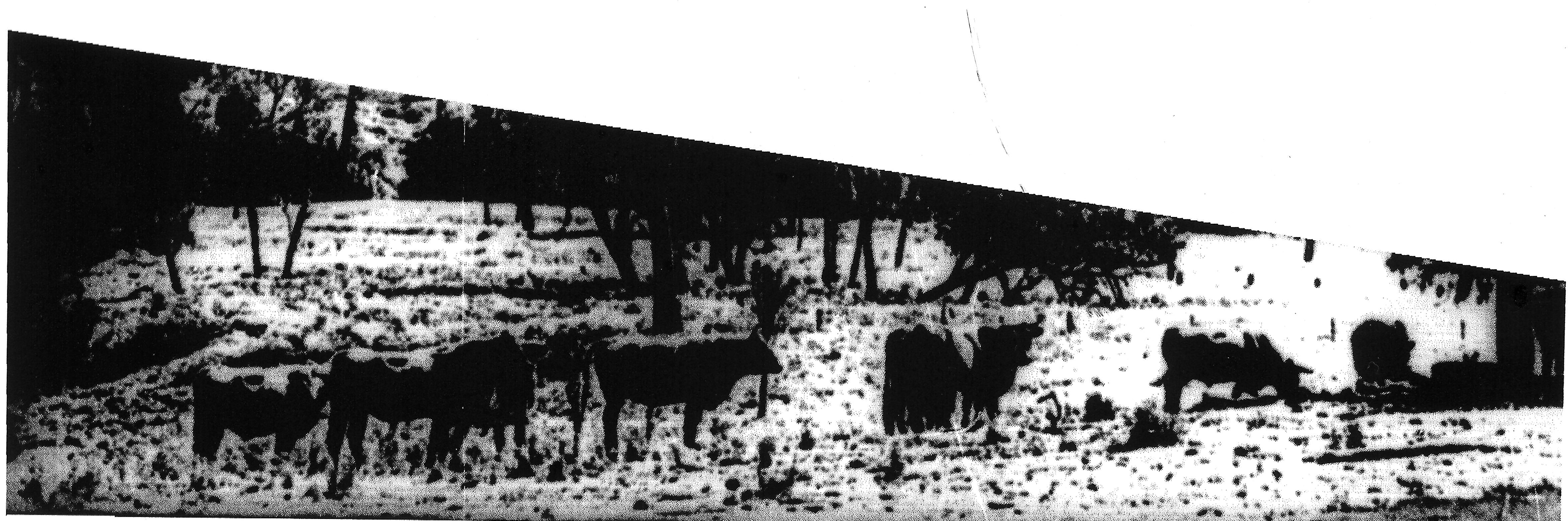
Other
buildings
Within the survey area were a few buildings
that did not relate directly to agricultural activities.
There were however. two churches and
a community hall. All three were of the
vernacular' form and each marked the
position of an established local community
or settlement. Their positioning at
road junctions or at hills was notable. and despite their being
insignificant in numerical terms, they were nevertheless quite
important in a visual sense.
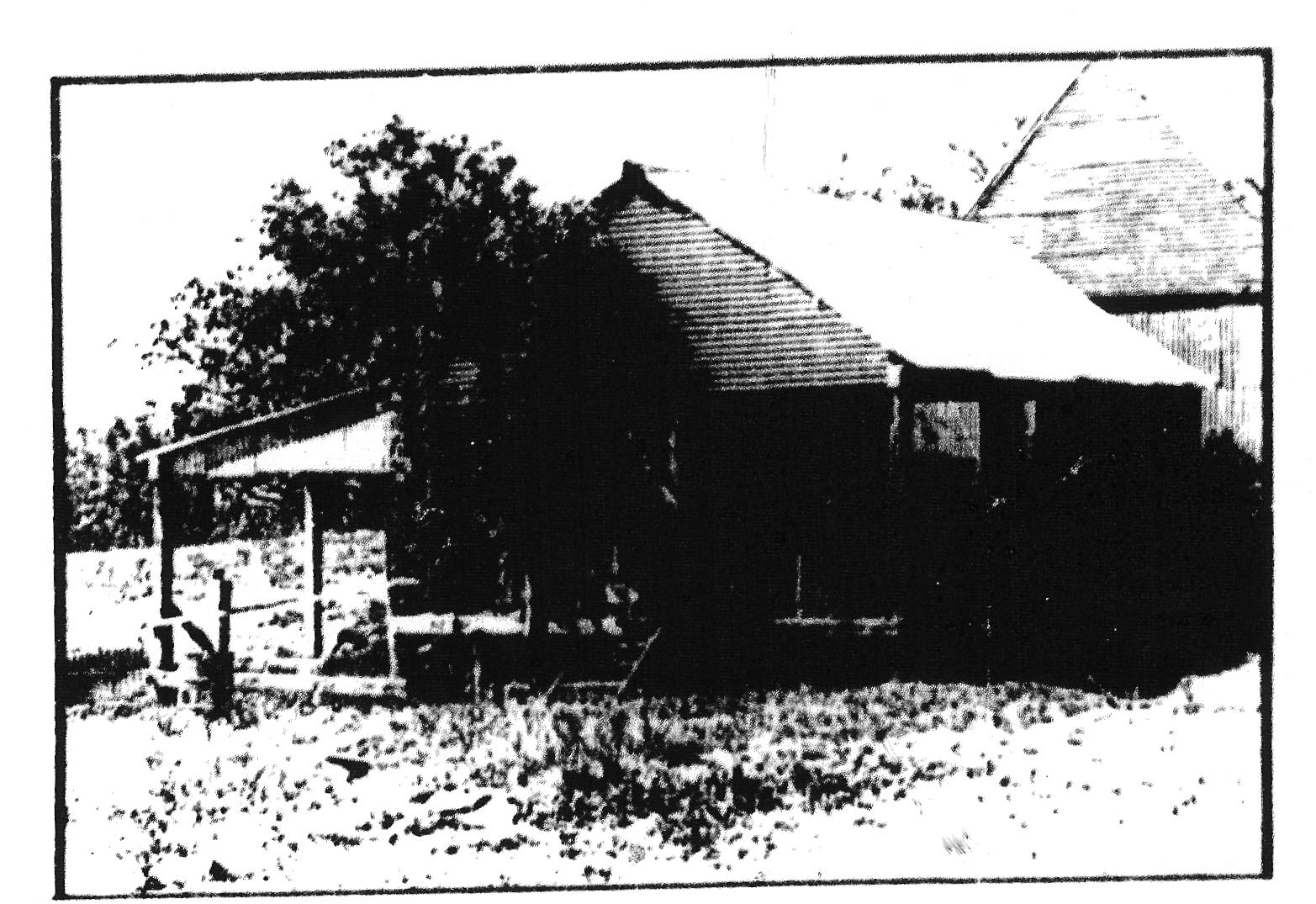
Slab hut (Apel)
Survey 81
This little stab building of 'primitive'
slab construction is largely intact.
An original timber shingle roof
still
covers, the building.
A corrugated iron stove recess/fireplace exists to one end.
of' the building although this may be
contemporary with the main structure is
more likely to be a later addition Th,icantbecause
ofthiss Sed addition and i'
is the touppo building (slab' andshingle
hut and 1ron fireplace) that is worthy of conservation action.
The bu1l di n, sits to the rear of a
' vernacular house on a farm most recently
owned by H. R. and E. S. Ape l and
probably was the original house on the
property reverting to its present use as a shed once the new house was
built.
The farmhouse itself is not of exceptional
value although evidence exists to show that it too may have been built
in stages.
The farmstead complex is typical of those 'ound throughout the area.
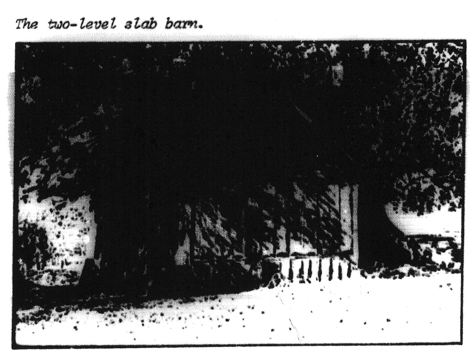
Farmstead complex (Conroy)
Survey 87
This group of farm buuild1ngs is amongst the most signi ficant
and important i n
the whole survey area.
Of primary importance is a two level barn of 'primitive' slab
conltruction. Although some 'transitional' featuNS are apparent (ie:
corrugated galvanised iron roof, sawn timber gable ends etc.), there is
sufficient e'Vidence of unique detail ing such as cavity slab
construction to the half basement and evidence of the buildings use as
a residence (remnants of stencil
work to some slabs) to make this building of National importance.
It sits within a farm complex almost as important as the building
itself. Stables. two storeyed barn/hay 10ft and single barns and
machinery sheds are arranged around a house paddock in apparently
care'ully planned manner. The arrangement is certainly visually
important.
A later homestead of 'transitional' construction having heavy hand work
to subfloor construction and sawn timber framing and cladding with
evidence 0' an earlier shingled roof is part of the complex.
Internallining to the house is of large dimensioned cedar boards.
Some outbuildings to the house (wash house, laundry,bakehouse etc.),
complete the complex.
Everywhere is evidence of 'primitive' construction. Woven wire fences
and post
and rail yards and dips are significant
for their use of naturally occurring materials and absence 0'
manufactured or imported ironmongry. Gate hinges and latche's are
fashioned from timber and all work is carried out to a high standard.
An intact
domestic rubbish tip adjacent to the complex and, although this has
been overturned by bottle collectors, is nevertheless still potentially
a most important source 0' archaeological evidence at the site.
Mature trees and traditional ,plantings further enhance the Site.
The most recent owner of the property was P.M. Conroy
and this fact
adds to the significance of the complex. The Conroy
Famil1 was iftstrumental in the early settlement and development of the
Brisbane Valley and the history 0' that family is inextricably
interwoven with the history of the area. (Note Survey No 328, a
earlier stab hut reputedty built by the same family).
Note also Survey No 86 and adjacent church which visua1ly and
historically is part
of the farmstead complex.
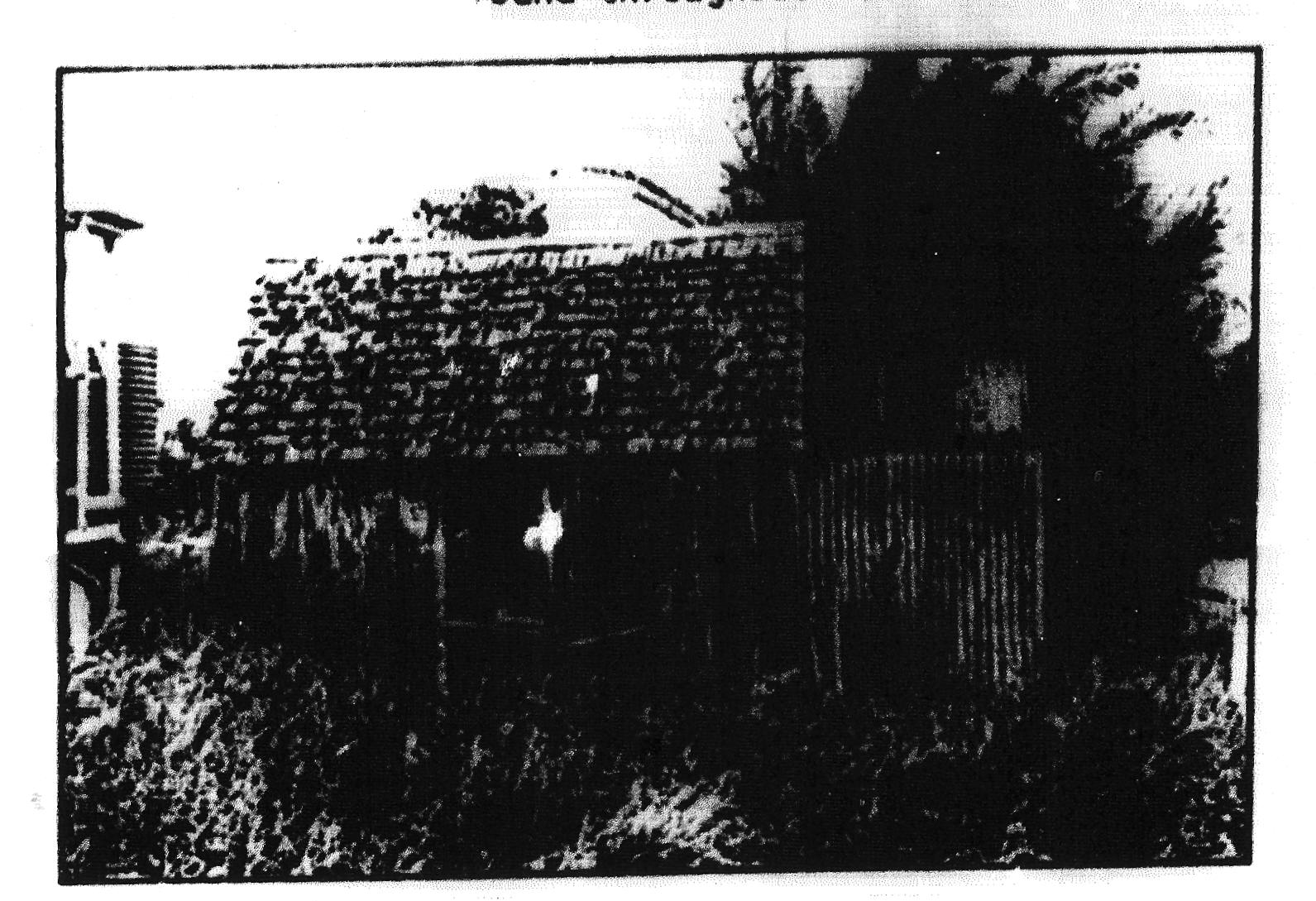
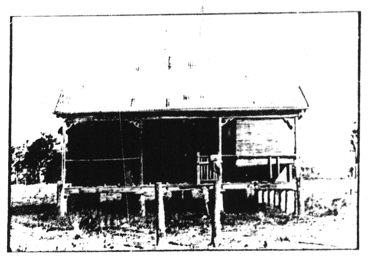
Slab barn
(North)
Sur'vey l64
One of a pair of particularly wel1
constructed timber barns at a property
most recently owned by the North Family,
the smaller barn is worthy of special
care and attention because of its 'primitive'
slab construction~ set off the ground on
timber stumps. Every detail within the
structure has been carefully considered and
the building is noteworthy for it's general
absence of ironmongry and imported fastenings.
The slabs are he 1 din top arId bot tom plate's
by a mortising technique arnd tie beams
and rafters are cut and fi tted toqether in
a most sophisticated manner.
Other buildings on the site are of lesser importance.
Farmstead
Complex (Freek)
Most recently owned by A A. Freek this complex of buildings is of
siqnificance because it represents well the typical small farmstead of
the region.
4 Other
Buildings
Orily three bulldings not associated with
agri cu 1 tural pursui ts were surveyed wi thi n t,he
inundation area. Of these the most significant.
are:
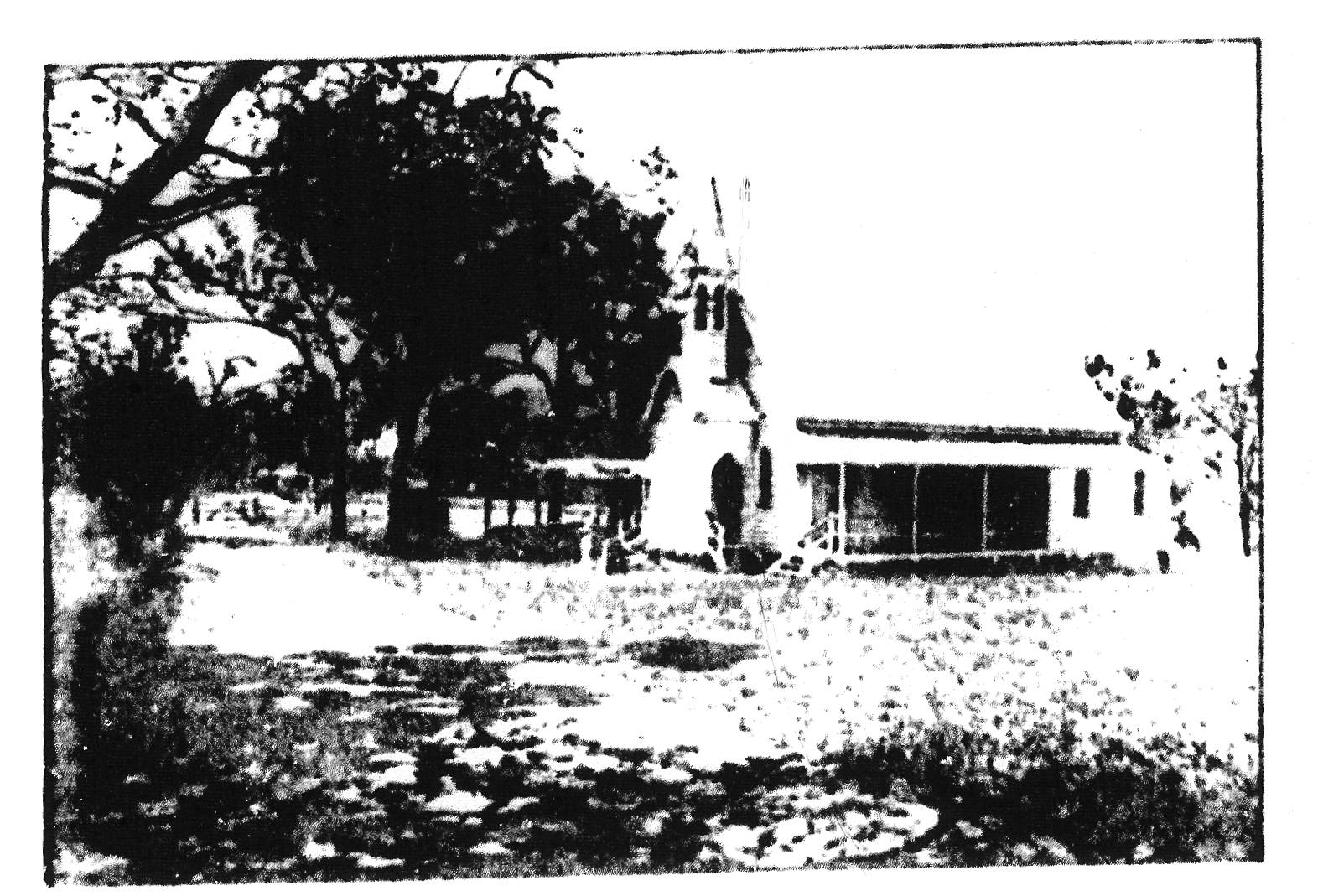
Caboonbah Church Survey 189
This weatherboard church dating from 1905 together with its
outbuildings is a
parti cul arly e legant example of vernacul ar' construction in an
ecclesiastical form.
Associated with the church are some out.
bu i l dngs and a small graveyard and the whole
complex intim,ately related to the history of the
area.
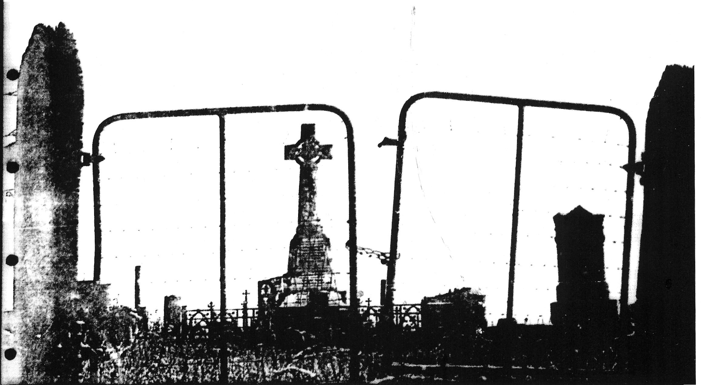
Church (Conroy)
Survey 86
This church and graveyard is, adjace'nt to and directly associated with
the Conroy Farmstead, in that many of the Conroy Family,' are
b,uried rhere. It is of great significance to the district.
out in such a way as to retain the significance of thle building on its
new site.
The choice of site should be made within a broad plan for the display
and interpretation of historic elements as outlined in Section 10.1.
The remaining buildings and elements ,at the site should be the subject
of a detailed photographic survey
Farmstead complex (Conroy) Survey 87
This most important complex of buildings which includes a two level
barn of National significance lies within an area which is not
directly affected by the flooding of t'he new dam. The enti re
camp1ex is wor' thy of the hi ghes t
standard of conservation action.
It is therefore recom7me,nded that the enti re farm complex be the
subjec:t of an ,extensive and detailed conservation
progrdmme' of the' highest order.
This will involve detailed survey and assessment of the entire complex,
historic research, archaeological' investigation and preparation of
stratetic plans for the ultimate conservation and ongoing maintenance
and use of the prop/.erty.
Note: The Historic property is
presently leased to the Queensland Institute of Technology as a field
study
c'e'ntre, It is the intention at
that.
orqanisoJtion to prep,are a .long term plian
for the conservation and future use oif
the property. Close supelvision of the
proposals and subsequent work 1s recomme'nde'd to ensure that the
highest standards ,11e maintained by the Institute ani that
'
support fcor ,proper and approved work be
given to the Institute wherever possible.
10.2.4 Carseldine
House
Survey 158
This house of 'transitional' form is
important because of its early construction
and generous scale. It has however been severely modified in a
'vernacular' idiom.
Although not within an area to be flooded the house is not thought to
be worthy of conservation. It is ,however important to record its
earlier form and surviving detail from that period.
Therefore it iS recommended that a careful and detailed me,asured study
be initiated to record the plan formn an1d c'onstructional details of
the house. This study should
be accompanied by a photographic survey
of the house and its immediate surrounds.10.2.5 Slab Barn (North)
Survey 164
This property will be completely inundated when the new Da m i s comp,l
e ted .The ba rn is of some value as evidence of
structural form and technique but not of sufficient value to warrant
its re-location and display away' from its original settinl.
It is therefore' r'ecomme'nded' that the barn
be the subject of detailed architectural measurement and recording and
that a full photographic survey be part of that study.
10.2.6 Farmstead complex (Freek) Survey 196
This farmstead complex is well clear of the flood waters of the
Wivenhoe Dam and therefore the buildings are capable of conservation on
their present site. Although lacking in the typical planting that
usually accompanies the ch,aracteri sti c farmstead complex of the area
the farm is nevertheless a typical and particularly
well preserved example of its type. In addition the detailing of
outbuildings
and yards is of particular significance.
,
This complex is not of the same significance as Conroy's (Survey' 87)
and does not demand a similar st,andard of
conservation action. It is
however worthy of some effort to ensure th,e preservation of at least
the more important elements within it.
It is therefore recommended that if possible a continued use be found
for this farmstead complex in such a way as to enable the gro'up of
buildings to remain in their present state.
This will involve detailed assessment of
individual items and careful planning for re-use. At the very least
detailed architectural recording and photographic survey should be
carried out.
10.2.7 Farmstead complex (Harris)
Survey 206,207
This property will be completely inundated by the flooding of the new
Dam. Although the earlier house a'nd outbuildings are
of significance their value is not such as to warrant their removal
from their original site.
It is therefore lecommended that a detailed archi tectural survey be
made of the' "transitional" and "primitive'" buildings
at this Site. such survely to incl iude'
measured drawings and detailed photographs of the buildings and their
settings.
10.2.8 Pakleppa House
Survey 218
This property lies right on the line of maximum flood level of the new
Dam. It is a most important building and worthy of conservation in its
own right. Although not part of a large complex the house nevertheless
has a close relationship with its site and should if possible be
conserved in its present location,
It is therefore recommended that detailed survey work be carried out in
conjunction
with engineers of the Irrigation and Water Supply Commission to
determine the' exact position of maximum flooding'.
If the results of this exercise indicate that the house might
reasonably remain then every effort should be made to conserve the
house where it stands. Detailed architectural survey, photographic and
archaeological work should be carried out and a plan developed for the
continued use of the house.
If on the other hand indications are that the present site is unsafe
then the house
should be removed to a safe site within the general area aft,er careful
preliminary studies have been carried out.
10.2.9 Slab Hut (Conroy)
Survey 328
This early slab building is of some significance to the region
historically.
In addition it has certain architectural features that make it worthy
of conservation. Unfortunately the site will be completely covered by
the Dam waters.
It is therefore recommended that the building be removed to a safe and
permanent location. Th,e removal of this buildinq should be carried out
under strict professional supervision and only after preliminary
measurement, photoqraphic and archaeological w'ork. The new Si te for
the bui lding should be decided within a broad plan for the display of
the historic evidence of 'the region.
10.2.10 Bellevue Homestead
Survey 327
The site of the former Bellevue Homestead i s, to be flooded by the
waters of the new Dam. The house itself has already been removed to a
s,afe location at the town of Coominya and only outbuildings remain at
the original site.
Although the general philosophy of conservation adopted in section 10.1
suggests that to move whole complexes of buildings to new sites it is
inappropriate in this instance the programme has already been initiated
and indeed the house and outbuildings at Bellevue Homestead are of
particular value and worthy of special consideration.
It is therefore recommended that
the remaining outbuildings at Bellevue Homestead be removed to safety
and be re-located adjacent to the original house at its new site at
Coominya in such a way as to reflect the original relationships between
the house and the various outbuildings.
Some measured studies of this complex have already been carried out by
the National Trust but further detailed architectural survey and
photographic work will be required
before dismantling the remaining buildings.
In addition archaeological work at the original house site and domestic
rubbish tips should be carried out before the flooding of the site.
10.2.11 Cattle Dips and Yards
Surveys 17, 53, 173,290
None of the yards assessed in section 8.0 as being of significance are
worthy of conservation in their own right. They are nevertheless worth
recording,
It is therefore recommended that the Dips and Yards of Surveys 17, 53,
173, 290 be
ful1y photographed and architectural drawings made of critical details
etc.
10.2.12 Fences, Gates and Grids
Surveys, 19, 20, 205
None of the fences or gates assessed in section 8.0 as being of
significance are worthy of conservation in their own right. They are
nevertheless worthy of recording.
It is therefore recommende'd that the gates and fenlces of Surveys I 9,
2O, and 205 be full y photographed and architectural drawings made of
critical details etc.
10.2.13 Caboonbah Church Survey 189
This Church is a particularly fine example of "vernacular" church
building and is worthy of conservation. The site is not to be coveredby
flood waters and the church may the, fore remain on its present site.
Although the church is no longer used on a regular basis the local
community is particularly keen to see it retained and it has formed a
small committee to that end.
It is therefore recommended that the church, its outbuildings and
graveyard
be conserved upon its present site by finding a compatible new or
continuing use for the complex. To this end the local community group
dedicated to the church's preservation should be encouraged and
supported in their elforts to maintain the site and buildings within a
broad plan for the conservation and preservation of historic material
within the area.
10.2.14 Church (Conroy)
Survey 86
This building and its associated grave yard has a direct historic
relationship with Conroy's farm (Survey 87) and therefore has
significance as part of that historic complex as well as to the area as
a whole. It lies above the maximum flood line of the new Dam.
It is therefore recommcnded that the church and graveyard be conserved
on its present site in association with plans to conserve the adjacent
farmstead c.omplex. Continuing sympatnic use should be found for the
building by the church or by the local community.
10.2.15 Bridges
Surveys 36, 80/220, 141
Conservation of the bridges assessed as being of significance in
section 8.0 of this report poses some problems in that all are flooded
by the new Dam and clearly to remove the bridges to high ground would
prove extraordinarily expensive. The bridges are characteristic of the
area but are not unique as examples of timber engineering.